
SHYC Chart View
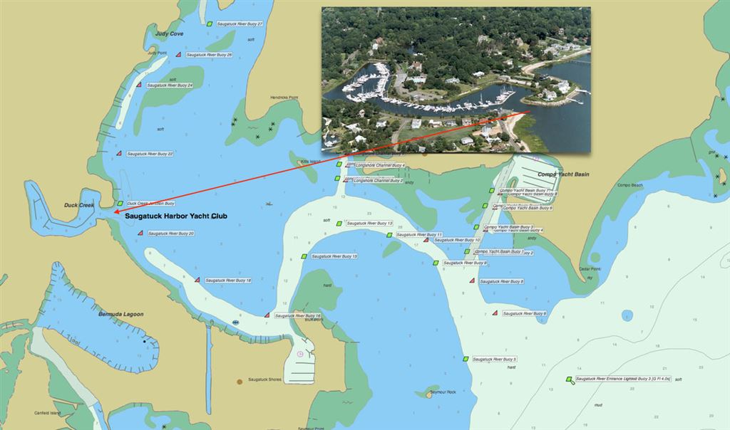
Above is a composite view of the greater harbor area and an inset aerial view of our club's basin which was created from Duck Pond in 1959. The entrance is on the right and the clubhouse and pool are just to the left of center. The fuel dock is on the left upon entering the basin from the Saugatuck River Channel.